On this webpage, members will find a collection of photos taken around our community, parcel maps of our housing plan, drawings, and other visuals related to our Association. If you have photos, maps, etc. you’d like to share with the community, please send them to the website editor.
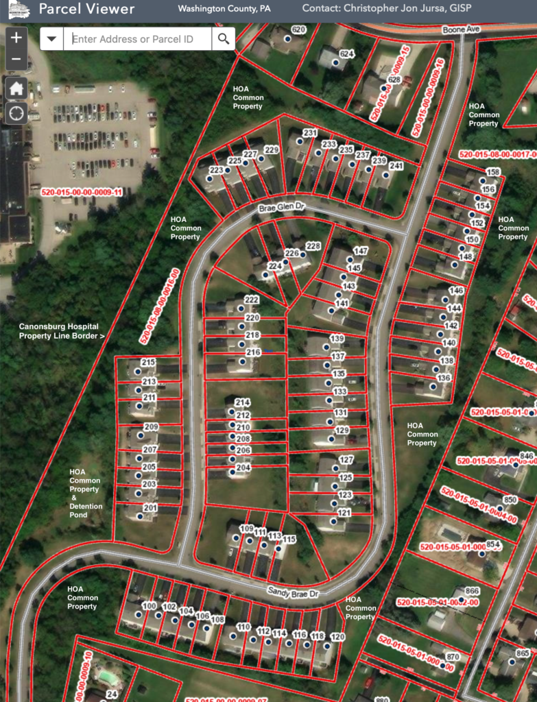
Parcel Maps: Below, the two Washington County, Pa. parcel maps demarcate the boundaries of our Association’s common property labeled HOA with the two contiguous parcels # 520-015-08-00-0016-00 and #520-015-08-00-0017-00 showing how all common property encircles the outer edges of our plan. In other words, the common property that our non-profit corporation owns is located only around the surrounding perimeter of our plan. All other property parcels within our plan are privately owned townhome lots designated with a street address number for easy reference.
Storm Water Management System Blueprints: Below, the collected drawings reveal the storm water drains, lawn & street catch basins and pipe system that funnels all Sandy Brae water from our townhome gutters, our lawns, driveways, our street curb-side drains and deposits this Rain and storm water into the dry detention pond located behind 201 Brae Glen Drive.
Below, you’ll find a growing collection of photos taken by residents.
End of Photos & Maps